Drone site surveys use aerial technology to collect accurate, detailed data from above, saving you both time and effort compared to traditional methods. With a drone, you can see large areas in minutes, spot issues fast and get high-quality images or maps without needing to be on site for hours. This technology is making surveys faster, safer and more reliable for many industries.
If you’re involved in construction, land development or even environmental work, drones can offer new ways to check progress, measure land and make decisions with more confidence.
Find out what makes modern drone surveying both practical and valuable for your next project and discover the efficiency and accuracy improvements they bring.
How drone site surveys work
Drone site surveys use advanced aerial technology to gather geospatial data quickly and safely. You can expect detailed outputs such as orthomosaic maps, 3D models and elevation maps, which support everything from construction to land assessment.
The drone surveying process
The process starts with planning and pre-flight checks. You or the drone pilot will programme the drone’s flight path to cover the survey area accurately. The drone uses GPS and mapping software to fly in straight, overlapping lines, ensuring data is collected from every angle.
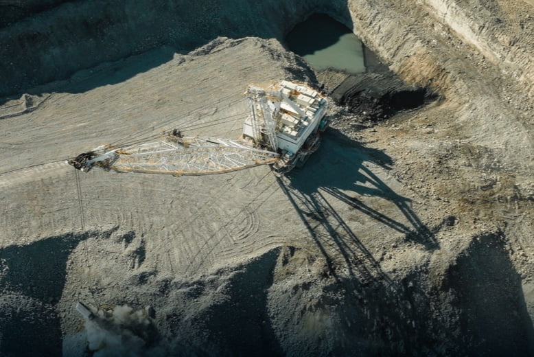
During the flight, the drone captures many images and sensor readings. Sites with difficult terrain or large stockpiles are easier to measure by air. This precise aerial surveying approach helps create consistent, repeatable results.
After the flight, you download the data onto a computer. The captured data is then processed using photogrammetry or LiDAR software, which stitches images together and produces detailed 3D models and maps.
Survey drones and technological tools
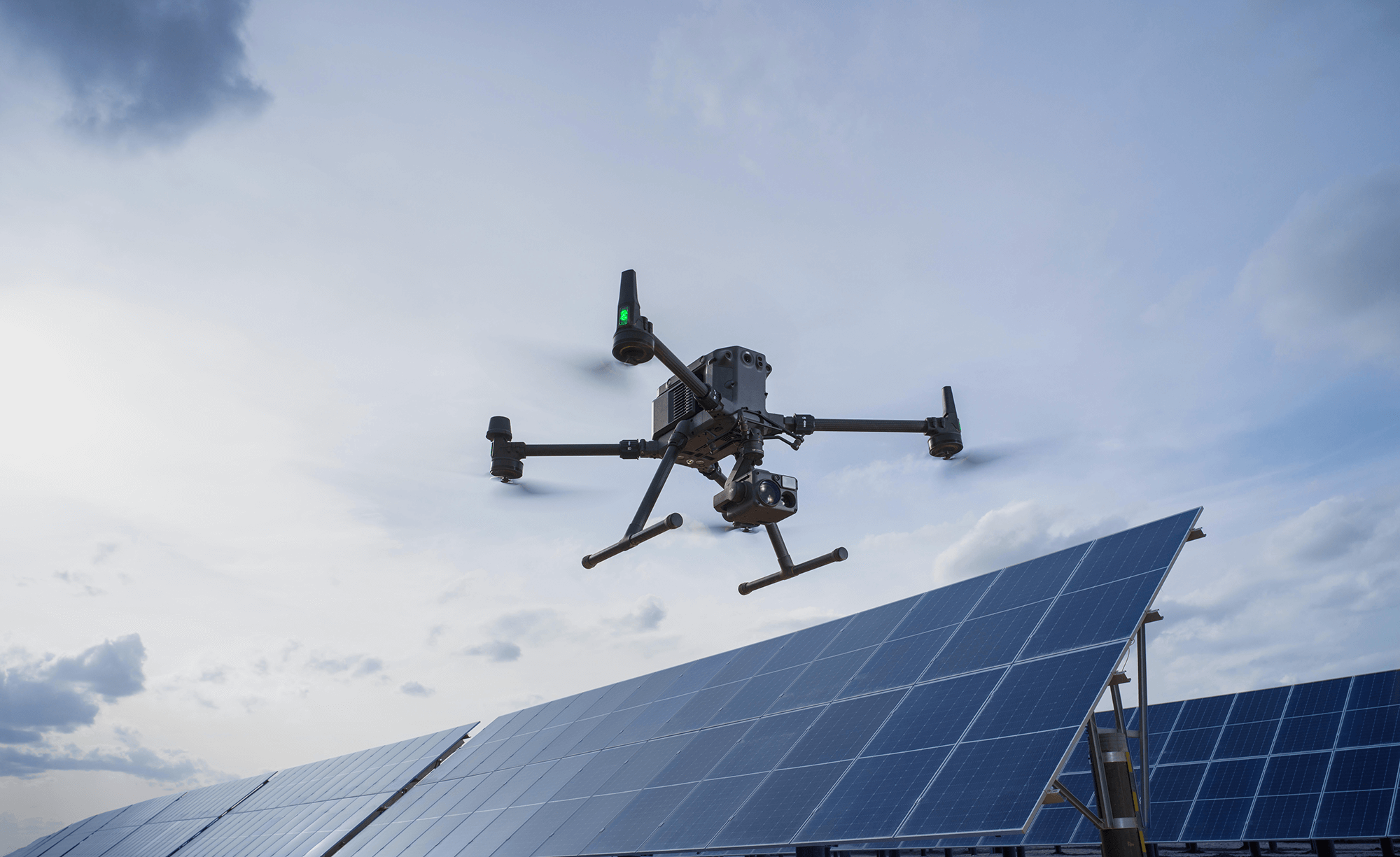
You’ll use drones equipped with high-resolution RGB cameras, multispectral or thermal imaging sensors depending on the project’s needs. Top models include LiDAR sensors for advanced 3D mapping and can operate in daylight or at night.
Drones collect robust datasets in minutes, avoiding the need for ladders, scaffolding or manual measuring tools. This makes the process safer and more cost-effective than traditional land surveying.
Modern survey drones offer safety features including obstacle detection, automated flight paths and real-time data transmission. Advanced models, like the DJI Matrice 4 range, have intelligent weather sensors that can provide forecasts and cease operations in hazardous conditions.
Aerial data capture and analysis
Drones collect detailed aerial data by capturing hundreds or thousands of overlapping images. Sensors can map large areas with centimetre-level accuracy. In a single flight, you can gather RGB, thermal or LiDAR data.
Photogrammetry software analyses these images to build precise 3D surface and reality models. You can extract contour data, create digital surface or elevation models and even generate volumetric measurements for stockpile management. Results like orthomosaic maps and point cloud data help with topographic surveys, inspections and construction planning.
Once analysed, you get detailed visual outputs and valuable geospatial insights. These support better planning, progress monitoring and decision-making for your project.
The benefits and applications of drone site surveys
Drone site surveys bring you faster data collection, improved accuracy and safer ways to inspect difficult areas. They are also more cost-effective than traditional surveying methods, because they don’t require additional personnel and take significantly less time. By using drones with advanced cameras, thermal sensors and specialist mapping tools, you get new options for projects that need reliable and clear information.
Enhanced accuracy and efficiency
Using drones for surveys gives you high-resolution images and precision imagery. Drones can capture large areas in a short time, providing you with more data than traditional manual methods. These aerial tools use GPS, LIDAR payloads and advanced GIS software to create geo-referenced orthomosaics that help with accurate mapping and planning.
With specialist hardware, like thermal sensors and cameras for aerial inspections, you can pick up issues such as heat loss, thermal bridging, and water ingress. Drone surveys also support scaffold-free inspections and can carry out roof condition surveys without the risks of climbing.
You benefit from faster earthworks models, slope monitoring and cut and fill calculations. Stockpile volumes can be measured for a sharp material management plan using volumetric data analysis and stockpile surveys. This saves both time and money, helping keep your projects on track and budget.
Environmental and safety advantages
Drones help you reduce the need for people to work at heights or in unsafe areas, like unstable roofs or wetlands. Scaffold-free inspections and drone-led surveys mean fewer work-related injuries and less disturbance to the environment.
With the use of remote LIDAR or even ground-penetrating radars, you can monitor land-use change, track vegetation index maps and study geological formations without damaging habitats. Drones also excel in environmental monitoring by spotting problems like illegal dumping or changes in water flow before they get worse.
You can perform thermal surveys and specialist photography to check for problems related to energy loss or leaks. Plus, using drones offers a faster way to get answers, making it easier to comply with safety rules and protect natural resources.
Industry-specific applications
Many industries now use drone services for unique needs. In construction, you can track progress, update earthwork models and complete volumetric data analysis for stockpile or cut and fill management. Telecoms and the power sector rely on drones for power line surveys and telecommunications infrastructure monitoring. This means less disruption and improved site coverage.
In real estate and land management, drones provide accurate cadastre maps, define the boundary of new land and create site-ready land-use change models. Roofers and building surveyors can use thermal imaging surveys and capture detail for every roof covering. Drones are also practical for aerial inspections of towers, utilities and other hard-to-reach assets.
Frequently asked questions
Drone site surveys use remote technology to collect accurate data quickly and safely. You can expect drones to make mapping and inspections more efficient in many work areas, including civil engineering and construction.
What are the advantages of using drone technology for site surveys?
Drones allow you to access hard-to-reach places without putting people at risk. They can gather high-quality images and measurements in less time than manual surveys. Using drones can also save money on labour and equipment.
How does drone mapping differ from traditional survey methods?
Drone mapping captures high-resolution aerial photos and data using unmanned aerial vehicles (UAVs). This remote method collects more detail over large areas than ground-based surveys, making it faster and often more accurate. It also requires fewer people on site, leading to better safety and efficiency.
What types of equipment are required for conducting a drone survey?
A standard drone survey kit includes a drone with a GPS system, camera and various sensors. Some drones carry special equipment like lidar scanners or thermal cameras for specific tasks. You may need batteries, a controller and software for flight planning and data management.
In what ways is drone surveying applied within the field of civil engineering?
Drones are used to map sites before construction starts, monitor progress and inspect completed structures. You can use drone surveys to check earthworks, measure stockpiles or create digital terrain models. This technology helps you spot problems early and keep projects on track.
More Articles
Drones in Construction: a Guide to Uses and Key Benefits
Working in construction, you know how important it is to keep projects safe, on schedule and within budget. Drones in construction can help you monitor your site, check progress and improve worker safety while saving both time and money. By using drones, you get high-resolution aerial imagery and data that used to take days to […]
A Guide to Unmanned Aerial Systems (UAS) & Business Use Cases
Unmanned aerial systems (UAS), often called drones, have quickly become valuable tools across different industries. You can use UAS for jobs like inspecting infrastructure, taking aerial photographs and studying the environment. Businesses are finding new ways to save time, reduce costs and improve safety by using drones for tasks that were once difficult or risky. […]
The Ultimate Guide to Autonomous Drones For Businesses
Autonomous drones offer exciting possibilities across various industries, where they can streamline operations, cut costs and boost efficiency like never before. Whether you are in construction, agriculture or security, these airborne innovations can make tasks easier and quicker. Autonomous drones can perform jobs such as surveying land, inspecting infrastructure or monitoring security. By automating these […]